Sydney airport map
You can find on this page the Sydney airports map to print and to download in PDF. The Sydney airport map presents terminals and gates of the international airport of Sydney in Australia.
Sydney airports map
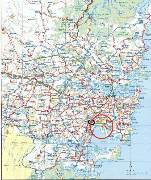
The Sydney airports map shows all the airports around Sydney. This airports map of Sydney will allow you to determine which airport you will used to leave Sydney in Australia. The Sydney airports map is downloadable in PDF, printable and free.
Sydney Airport, in the suburb of Mascot, is Sydney main airport, and is one of the oldest continually operated airports in the world. The smaller Bankstown Airport mainly serves private and general aviation. There is a light aviation airfield at Camden. RAAF Base Richmond lies to the north-west of the city as its mentioned in Sydney airports map.
Sydney international airport map
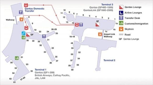
The map of Sydney airport presents the main international airport of Sydney. This international airport map of Sydney will allow you to determine by which terminal and gate you will arrive or leave Sydney in Australia. The airport Sydney map is downloadable in PDF, printable and free.
Sydney international airport has three passenger terminals. The International Terminal is separated from the other two by a runway, therefore connecting passengers need to allow for longer transfer times. Sydney international airport provides a shuttle service between the terminals at a cost of A$5.50. Terminal 1 was opened on 3 May 1970, replacing the old Overseas Passenger Terminal (which was located where Terminal 3 stands now) and has been greatly expanded since then. Terminal 2, located in the airport north-eastern section as its shown in Sydney international airport map, was the former home of Ansett Australia domestic operations. erminal 3 is a domestic terminal, serving Qantas and Qantaslink flights to Canberra. Originally, it was home for Trans Australia Airlines (later named Australian Airlines).