Sydney bike map
You can find on this page the Sydney bike map to print and to download in PDF. The Sydney bicycle map presents the bike routes and lanes of Sydney in Australia.
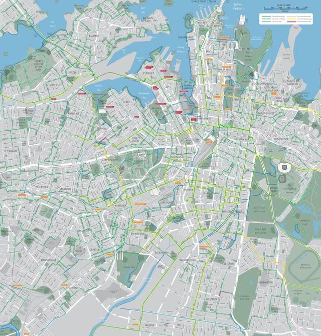
Sydney bike lane map
The Sydney bike lane map shows all the bike routes of Sydney. This bicycles lanes map of Sydney will allow you to easily plan your routes with a bike in Sydney in Australia. The Sydney bike lanes map is downloadable in PDF, printable and free.
Thanks to its many bikeways, bike lanes and shared paths, Sydney is a bike-friendly city. You will find a variety of places to hire a bike throughout Sydney and its suburbs, with plenty of great biking routes, from coastal cycleways to inner-city bike paths, waiting to be discovered as its mentioned in Sydney bike lane map.