Sydney train map
You can find on this page the Sydney trains map to print and to download in PDF. The Sydney trains map presents the rail network and railway stations of the trains of Sydney in Australia.
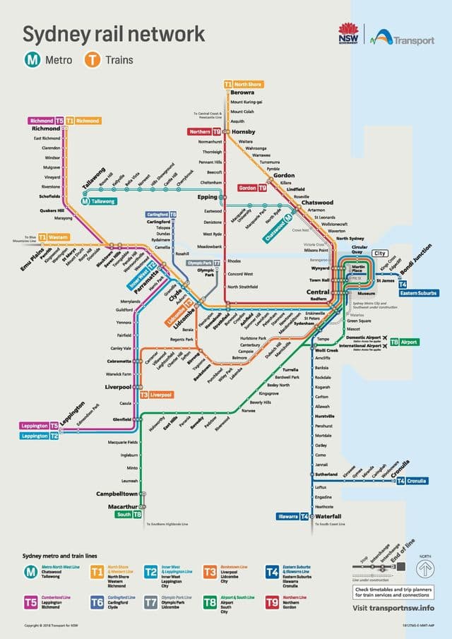
Sydney rail map
The Sydney rails map shows all the railway stations and lines of Sydney trains. This railway map of Sydney will allow you to easily plan your route with the trains of Sydney in Australia. The Sydney rails map is downloadable in PDF, printable and free.
Trains run as suburban commuter rail services in the outer suburbs, then converge in an underground city loop service in the central business district as its mentioned in Sydney rail map. In the years following the 2000 Olympics, CityRail performance declined significantly. In 2005, CityRail introduced a revised timetable and employed more drivers. A large rail infrastructure project, the Clearways project, is scheduled to be completed by 2010.