Sydney topographic map
You can find on this page the Sydney topographic map to print and to download in PDF. The Sydney elevation map present the topography, river and relief of Sydney in Australia.
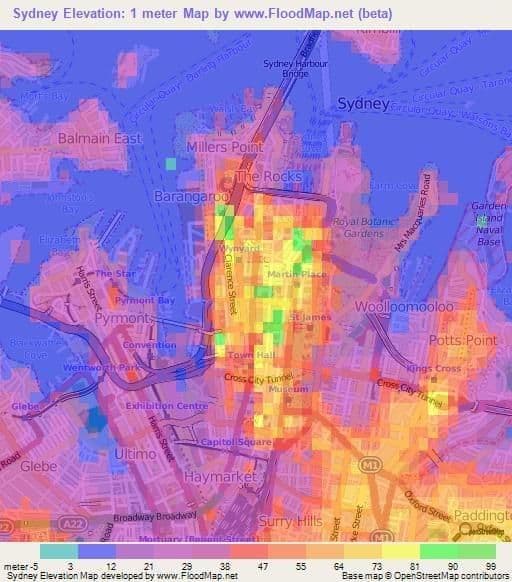
Sydney elevation map
The Sydney topographic map shows elevation, hills and landforms in Sydney. This elevation map of Sydney will allow you to know topography, river and relief of Sydney in Australia. The Sydney topographic map is downloadable in PDF, printable and free.
It is either in or out of the metropolis, according to the various definitions, but Sydney highest natural elevation point, according to the Department of Information Technology and Management, is at Woronora Trig Station, about 5km south west of Heathcote as its mentioned in Sydney elevation map. The trig station is 281.88m above sea level.